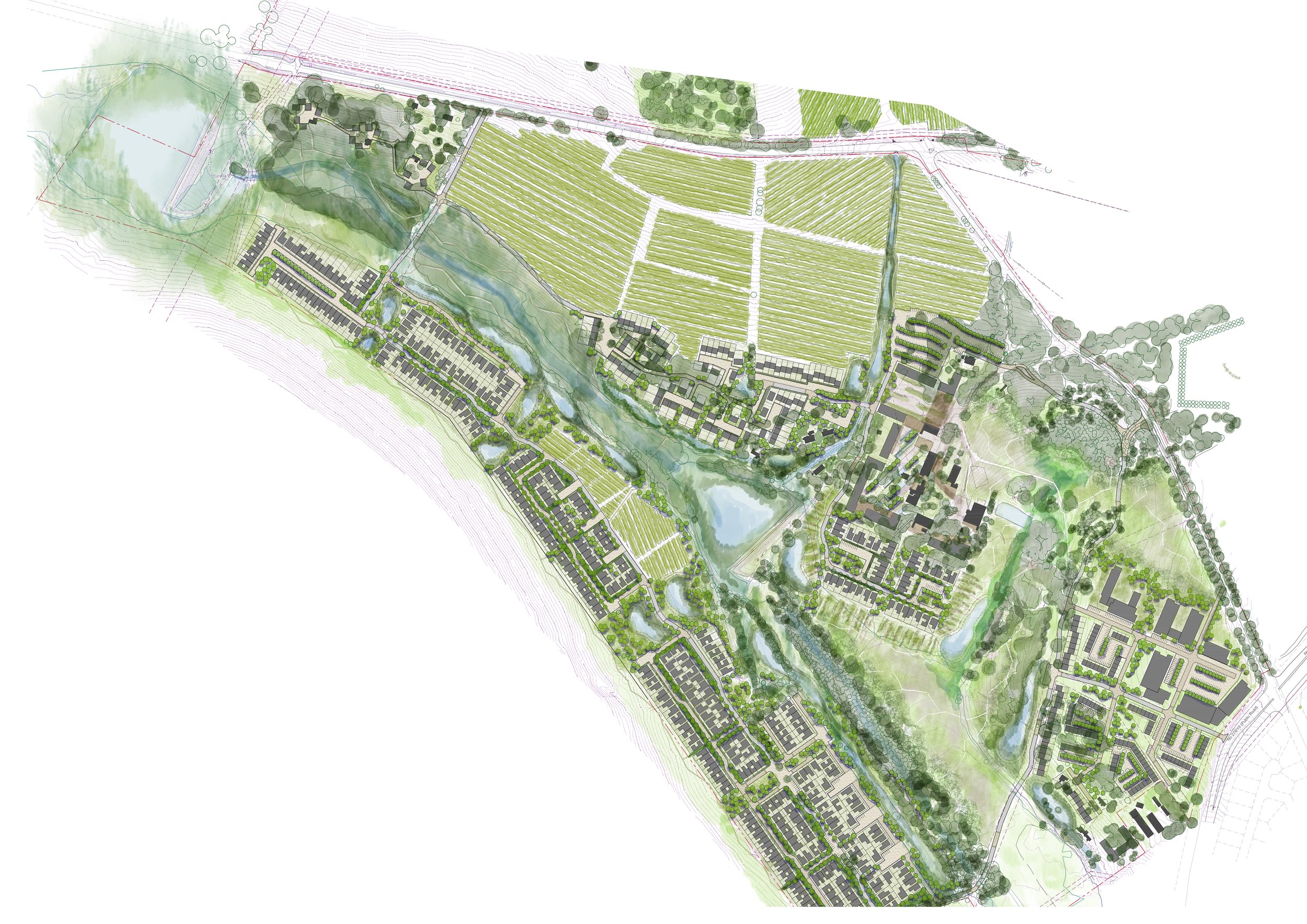
Altydgedacht Framework Plan


Image courtesy of Herman Lintvelt
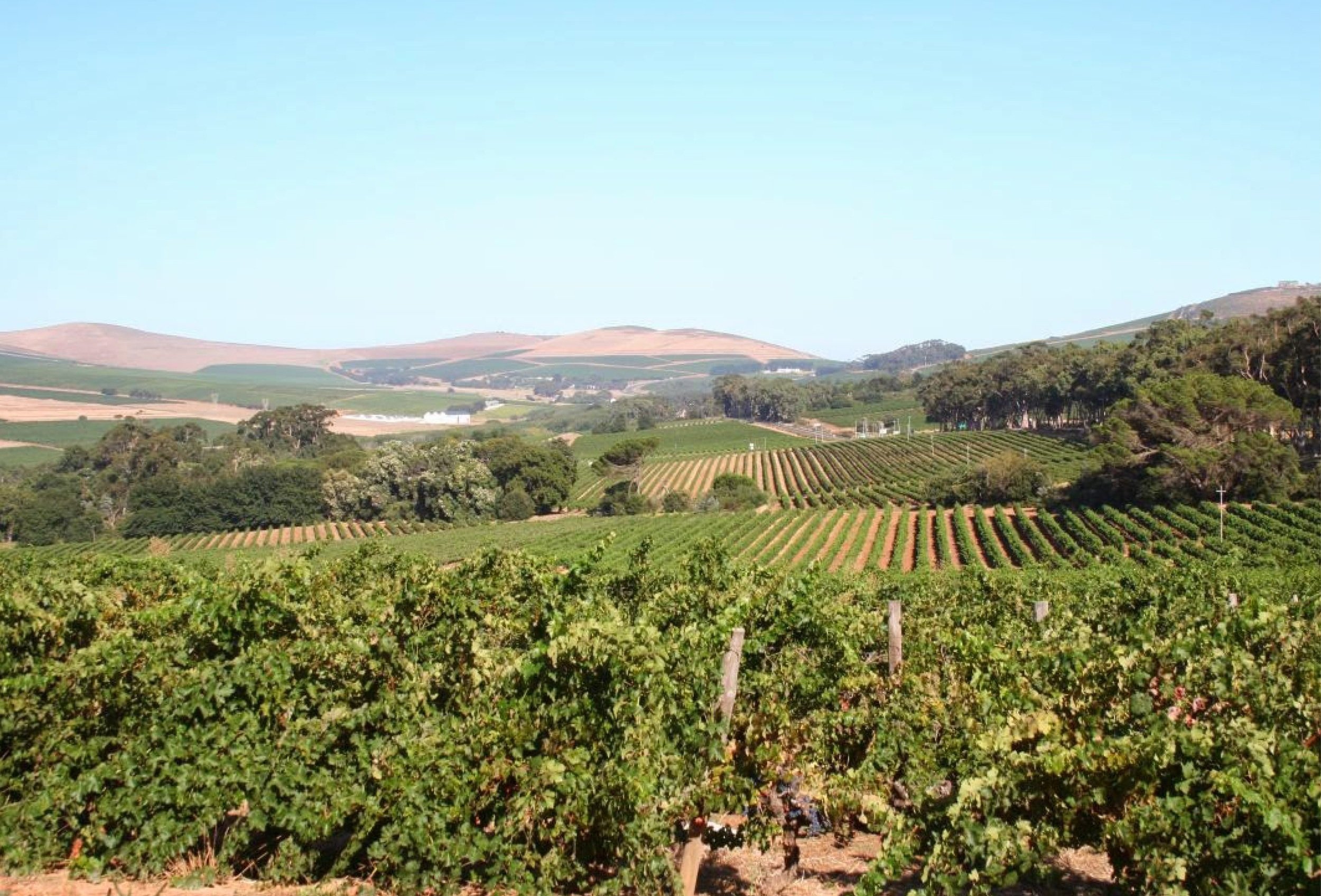
The proposed development lies in the valley created by the rolling hills of Malmesbury shale, with the Elsieskraal river as the prominent stream trans versing the site.
As part of the concept development a visual study and landscape character analysis has been done on the site . The rural quality of the area and the particular layout of the werf were both qualities that were deemed attributes to the site. Further to this the extensive tree planting on site and the visual buffer this provides is another quality which can be built on and developed further to add to the particular identity and sense of place.


The site boasts lush tree planting, meadows, and vineyards. Unlike conventional farming methods, trees are organically clustered, with straight entrance avenues. Walkways offer diverse angles and natural routes, except for entry roads. Access to the river and ecological paths is neglected. Forests and tree arrangements lack coherence, with existing pastures for livestock. Enhancing forest quality and the river corridor can elevate the site's attractiveness. Meadows and open spaces can function as ecological corridors and amenities, rather than maintenance burdens.


The main ideas behind the design proposal focus on structuring spaces for a distinct character. Leveraging natural and urban systems enriches the identity. Recognizing site features like drainage lines offers opportunities for a comprehensive green system, enhancing the development's sense of place. Detailed design of development pockets adds individual character to each area, addressing various aspects of the proposal.

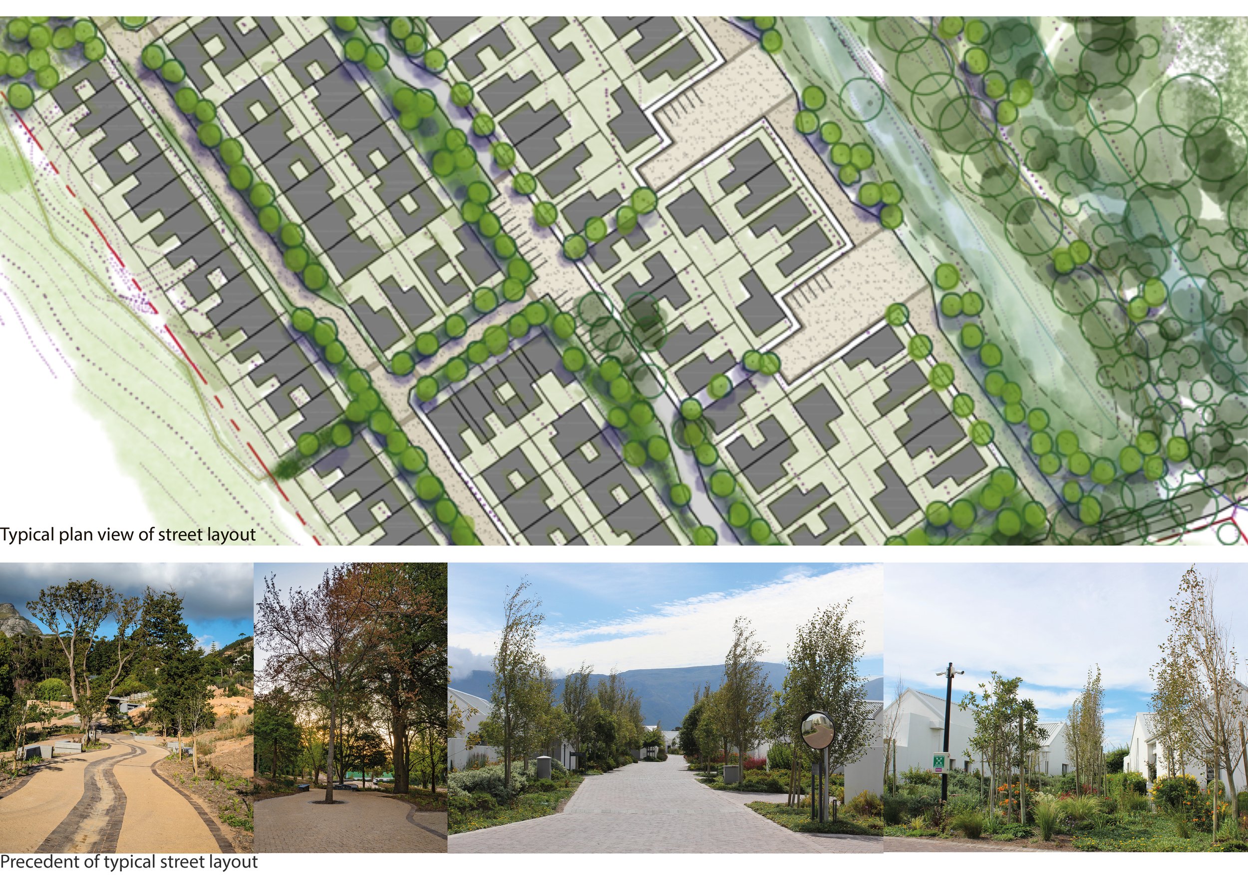
In principle the site should be pedestrian friendly and conducive to comfortable and accessible spaces for people. The design intent of all the public green spaces is to have these integrated in the overall design and accessible for everyone.

The site is trans-versed by the Elsieskraal river which is currently overgrown and under-utilised. The river is one of the most valuable assets and potential amenities for the proposed development and requires rehabilitation to a more natural state, closer to an functional, healthy ecological system.
The success of this will determine the future use and potential of this amenity and positive connection to the broader context.

An important aspect of the farm and the rural nature is the presence of meadows edged by the clusters of trees and forest. From the major approach road, farm buildings and dwellings are seen in the distance with the fields and meadows in the foreground. This is one of the strong landscape typologies that provides such a strong rural character to the site. As with the river corridor and development of the ecological corridors, this aspect must be upgraded to become a real amenity for the property.

There will be a hierarchy of systems connecting the stormwater management at the source through to the larger detention facilities allowing recharge of the groundwater.


The existing houses and proposed buildings are clustered within a mature forest of non-native trees. The plan involves monitoring the existing trees to select the most important ones for preservation. Over time, the aim is to replant the forest with indigenous species while preserving the spatial quality offered by the mature trees.

The westward development will echo the farm village's approach, except for a section adjacent to vineyards, enveloped by trees. Visual mitigation aligns with the hill houses and farm village, with tree clusters enhancing existing foliage.


The landscape approach and strategy or methodology will be one of mimicking the planting and grouping of plants in their natural setting and allowing for the active development and action of senescence to take place. This implies that the maintenance period is an active part of the design process and future implementation of soft-landscaping should take this into account.

Have a look at the Altydgedacht Landscape Character & Visual Analysis