Altydgedacht Landscape Character & Visual Analysis
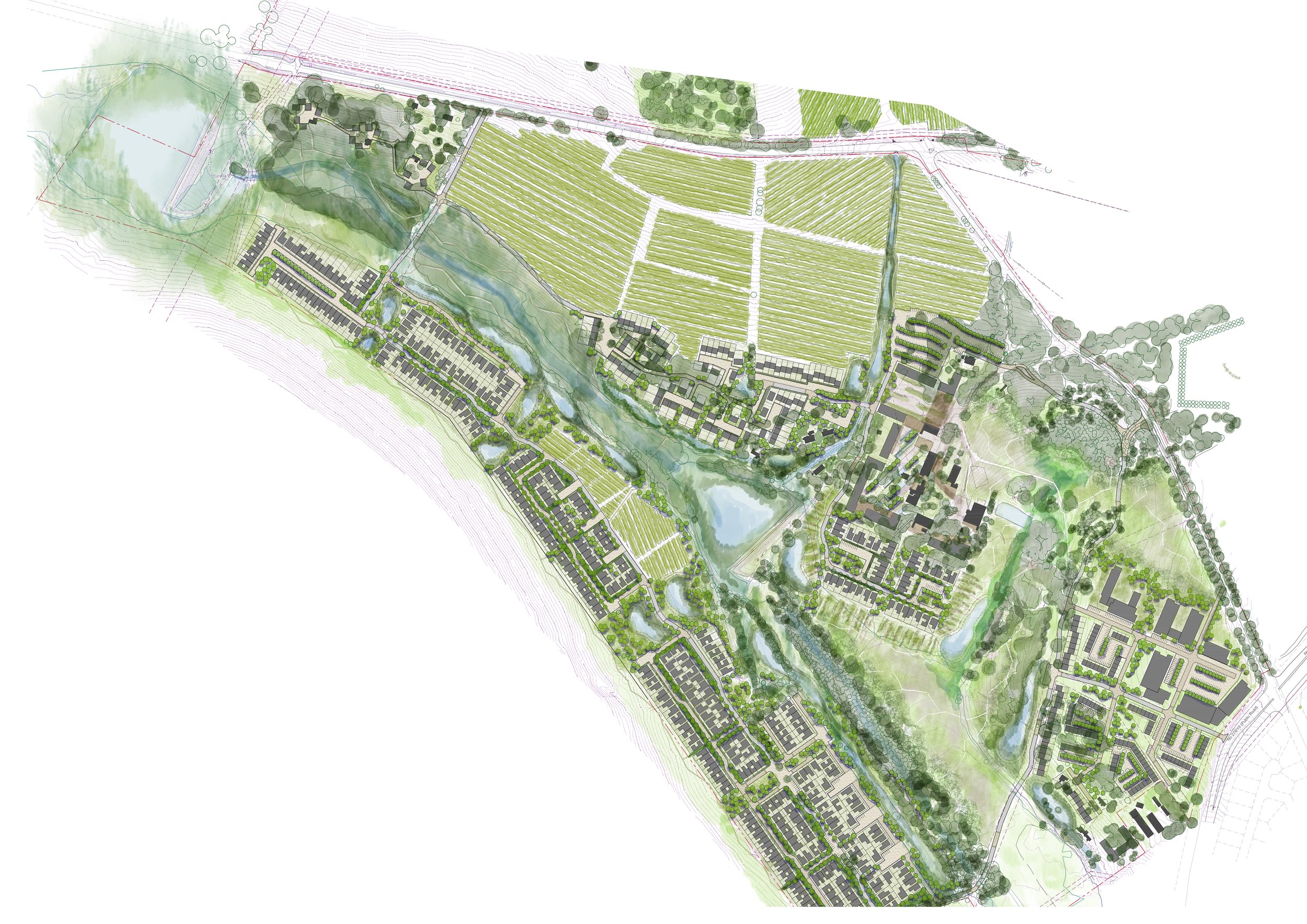
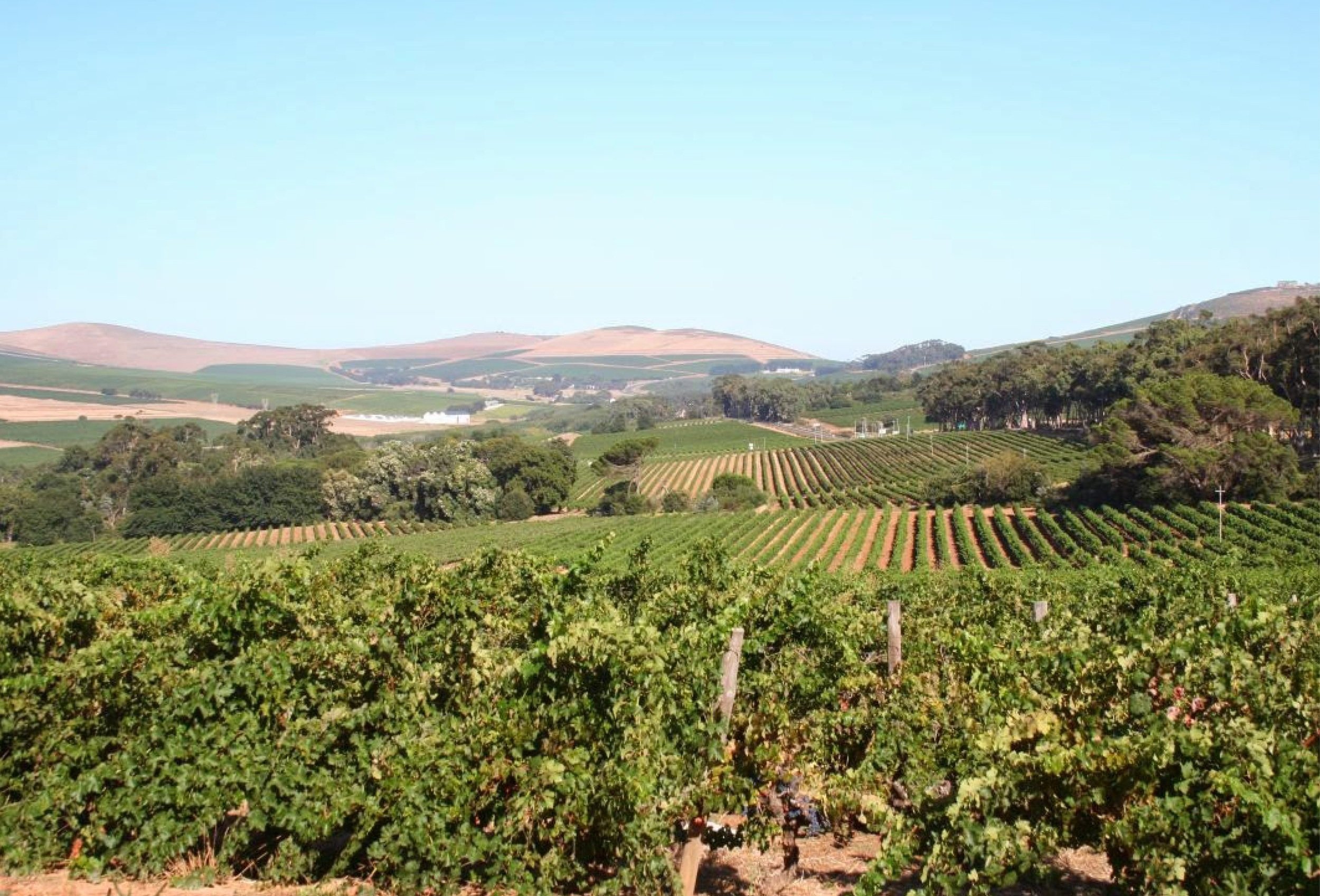
Image courtesy of Herman Lintvelt
Terra+ Landscape Architects was appointed by VDMV Property Holdings for a baseline Visual Assessment of Altydgedacht Estate (Farm 18/276) in Durbanville. Visual, scenic, and aesthetic components are valuable resources contributing to the cultural landscape and heritage. The assessment aimed to analyze the site visually to provide indicators for future development. This strategic assessment then informed design guidelines and planning processes, ensuring the conservation of visual environments and mitigating significant visual impacts.
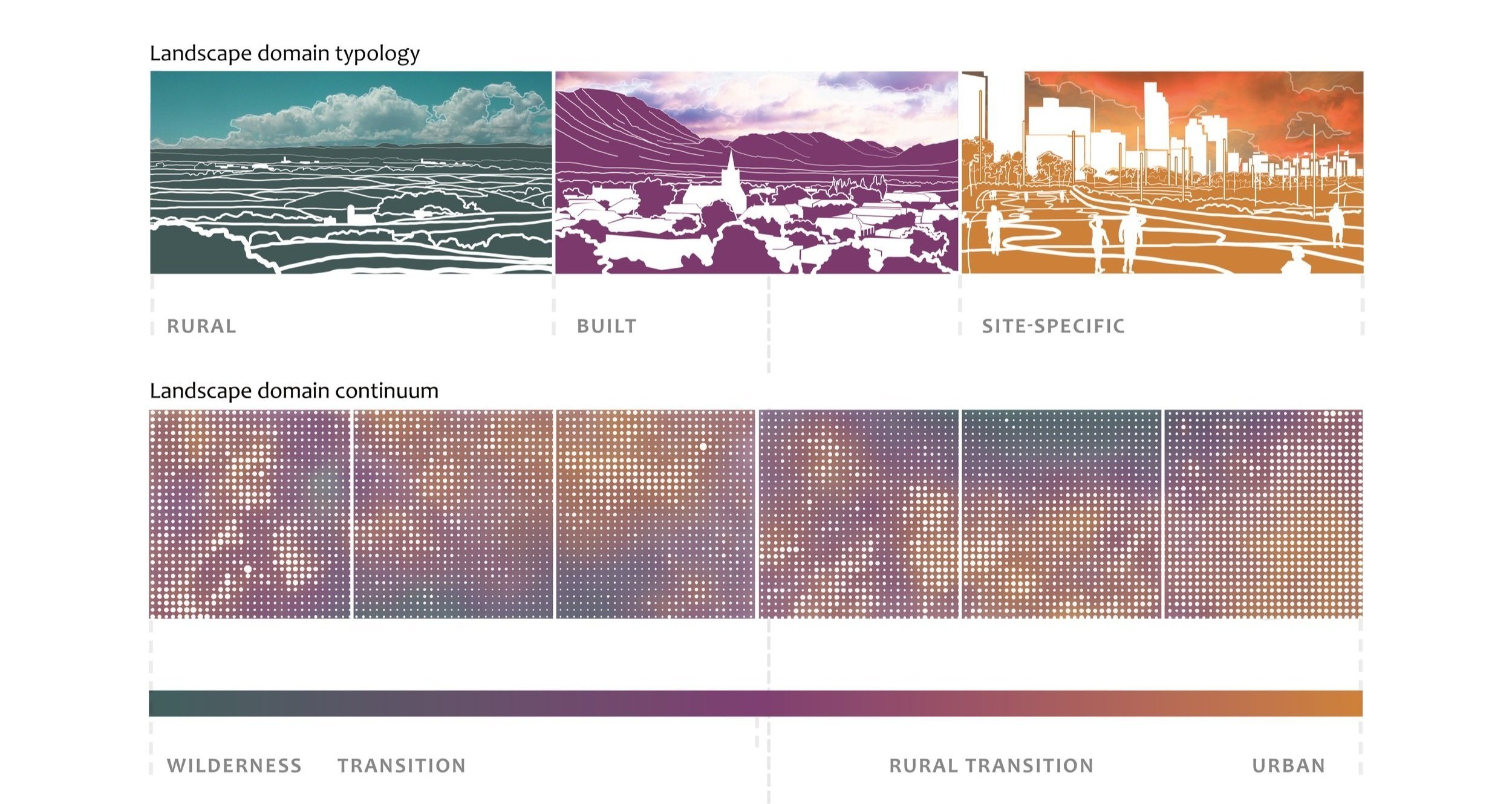
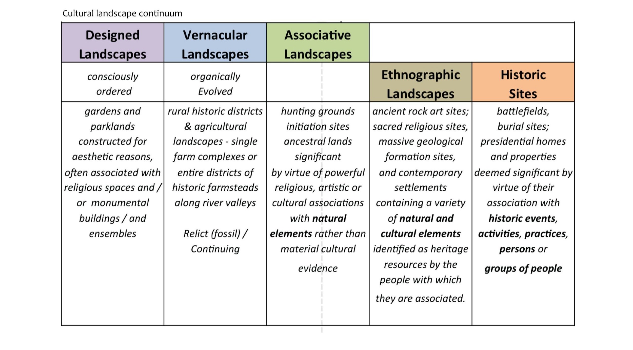
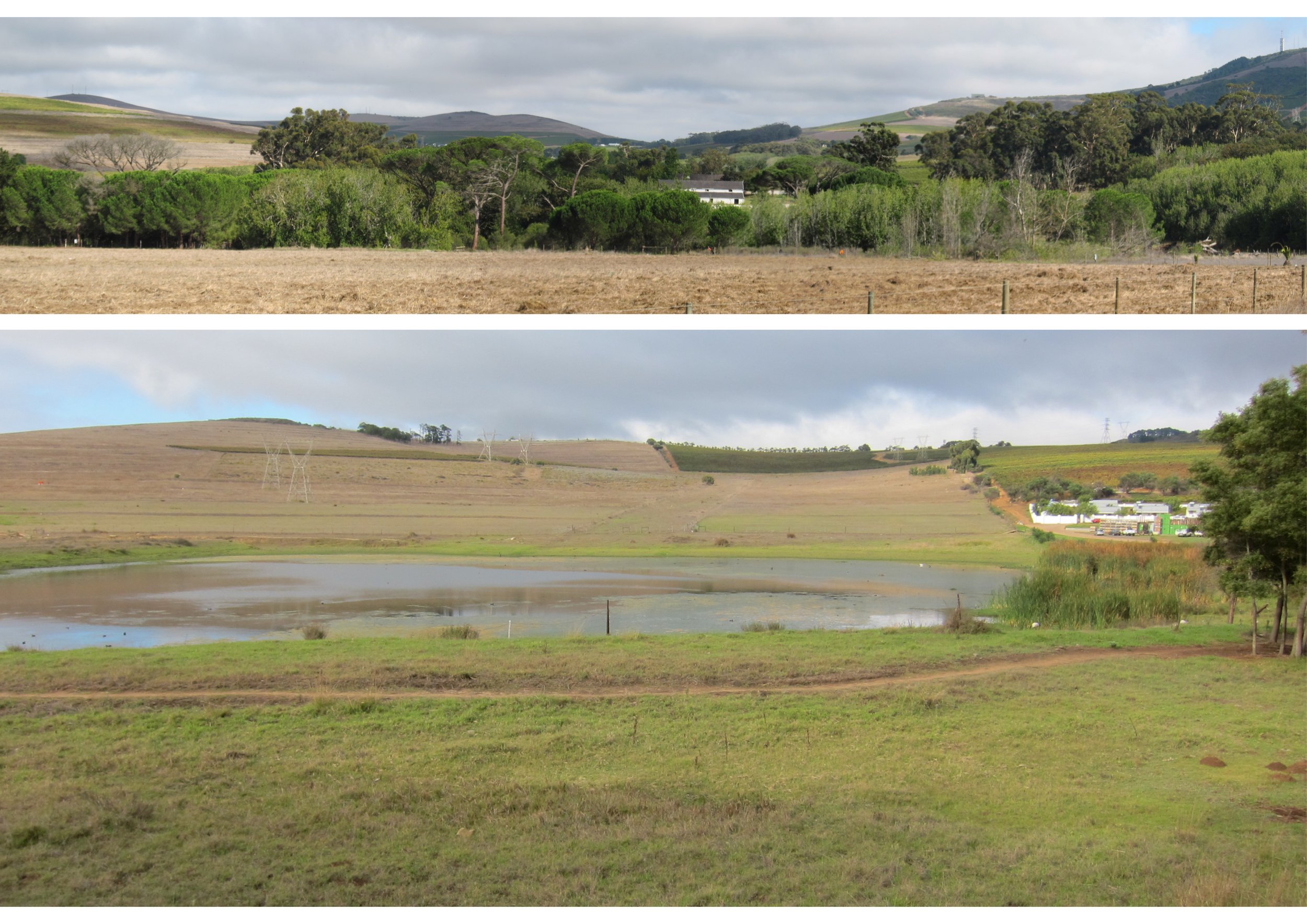
The analysis starts with the macro context, exploring the significance of the site within the city context, and then narrows into the local and site context. The environmental, physical and historical context is evaluated at these different scales. Capturing of cultural landscape elements runs parallel to this exercise, as the environment in which the site is located is rich in cultural heritage and scenic significance.
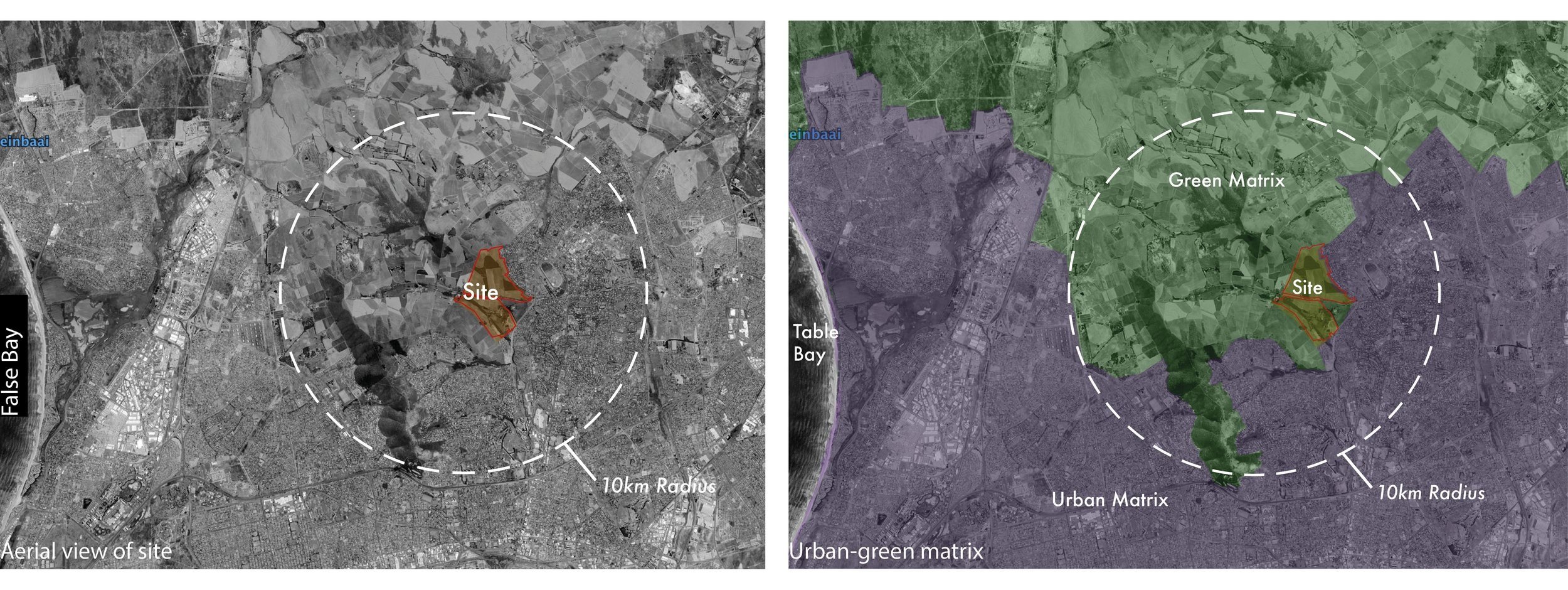
In the macro context, the following features were studied: Peaks & Ridges near the site, valleys, access, river systems, natural green areas, agricultural land, gateways and urban-green matrix.
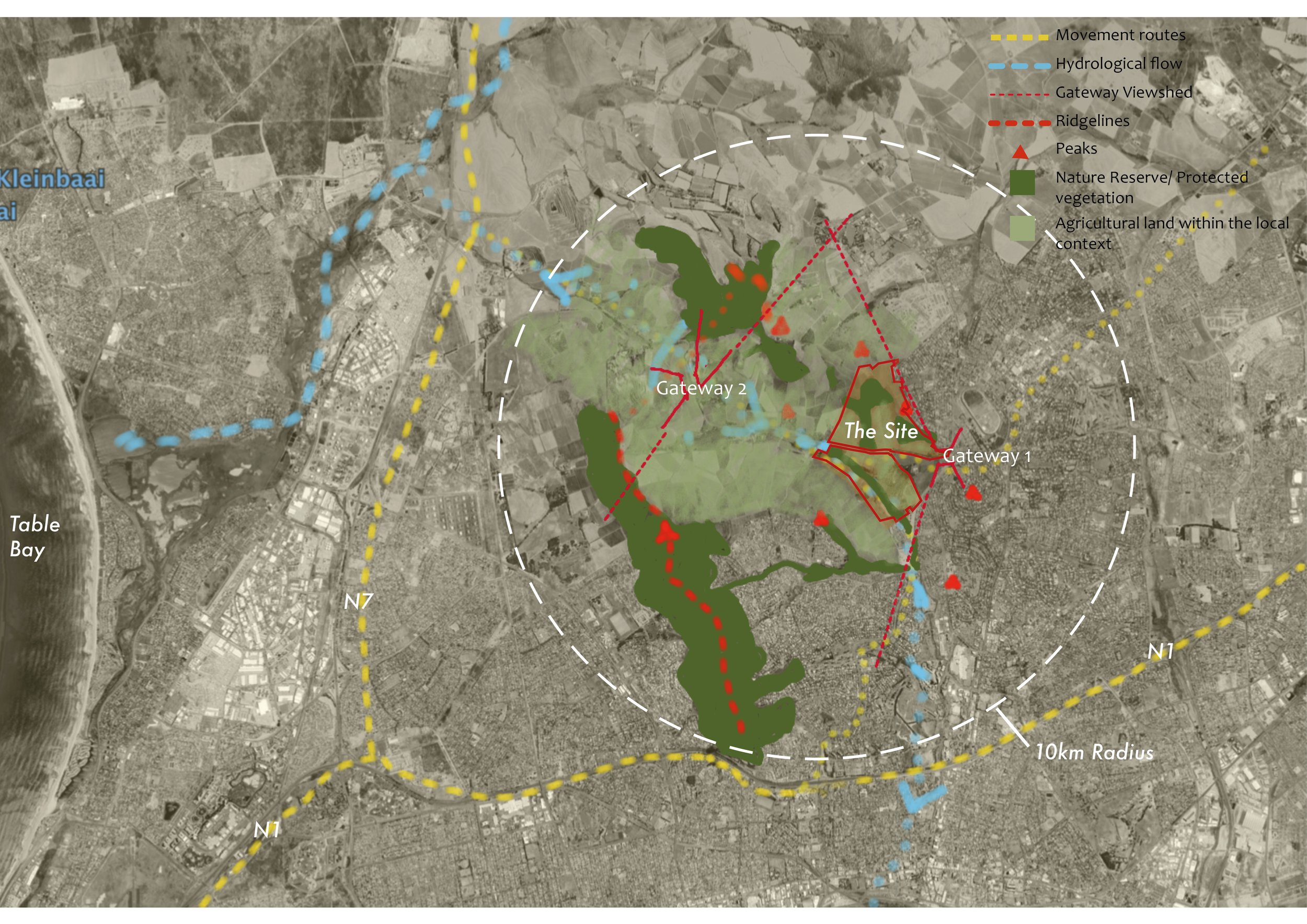
In ther macro context, the following insights emerged: The Durbanville Hill Range lies northeast of Cape Town, forming a physical and visual boundary against the flat terrain stretching from Table Mountain Range to the Durbanville hills. Nestled behind these hills, the site enjoys some protection from the harsh west coast climate. Positioned between the N1 and N7 highways, arterial routes connect the site, following natural valleys from east to west. The coastline, approximately 11km away, is visible at this scale, while the Diep River and Kuils River flow parallel on either side of the Durbanville Hill Range, with the site situated on the cooler, less dry eastern side. It sits along a green network extending from the north, comprised of protected reserves, open hillsides, and agriculture. Positioned at the urban-rural interface, at the foot of the Durbanville Hills, the site marks the former urban edge boundary, now blurred as urban development extends northwards.
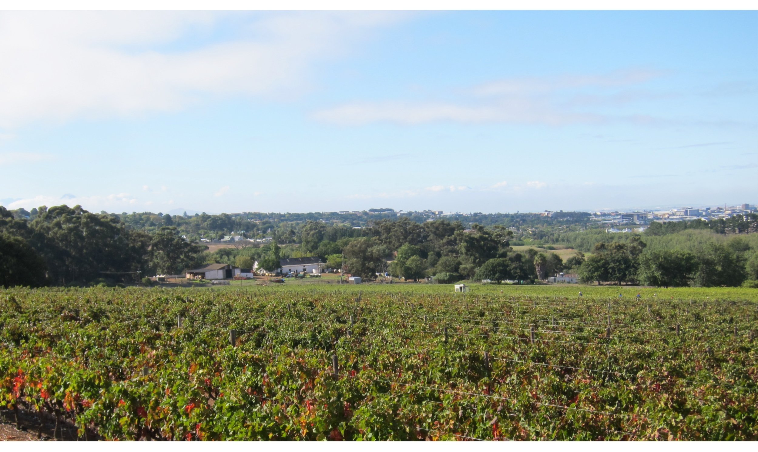
In the local context analysis, we examined several features, including landform and topography, hydrology, figure-ground relationships, tree patterns, agricultural patterns, natural green areas, and access points. Additionally, we explored a typical representation of a classical landscape and its relevance to the Altydgedacht site.
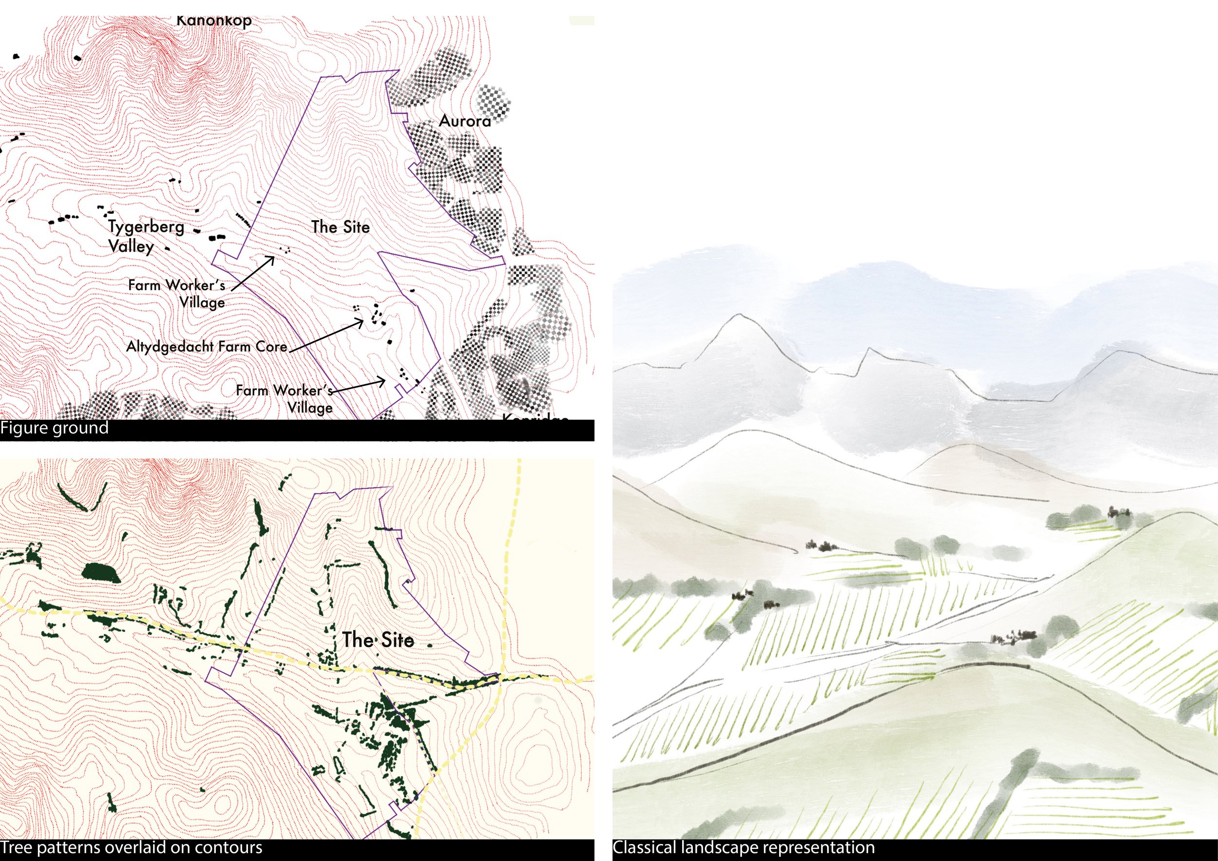
The first figure-ground diagram above reveals the distribution and density of built structures, indicating urban morphologies and rural settlements. The proximity of dense residential areas to rural clusters of farms is depicted, with Altydgedacht Farm boundaries bordering residential suburbs. In the second diagram above it is revealed that linear tree alignments define and frame the landscape, providing edge definition and shelter. Dominant tree avenues mark historical routes, while distinctive tree lines denote property boundaries and follow landform contours. Densely forested areas are present in sheltered valley parts. The large sketch attempts to capture the particular quality of the landscape and the dispersal of settlement. It is a landscape where homesteads and their associated buildings are “tucked” in the landscape, surrounded by agricultural patterns and tree-lines and with mountains forming the backdrop to this rural landscape.
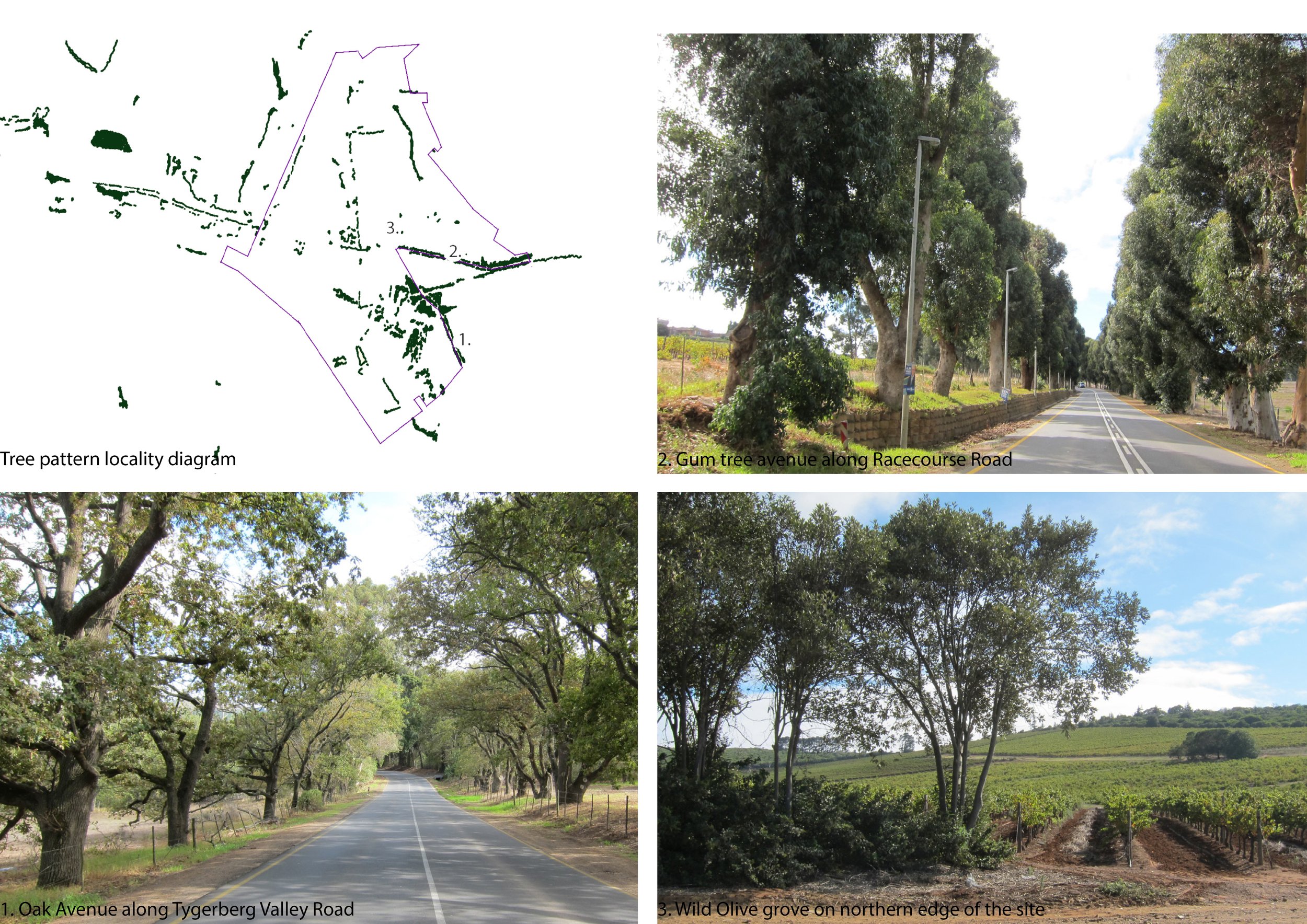
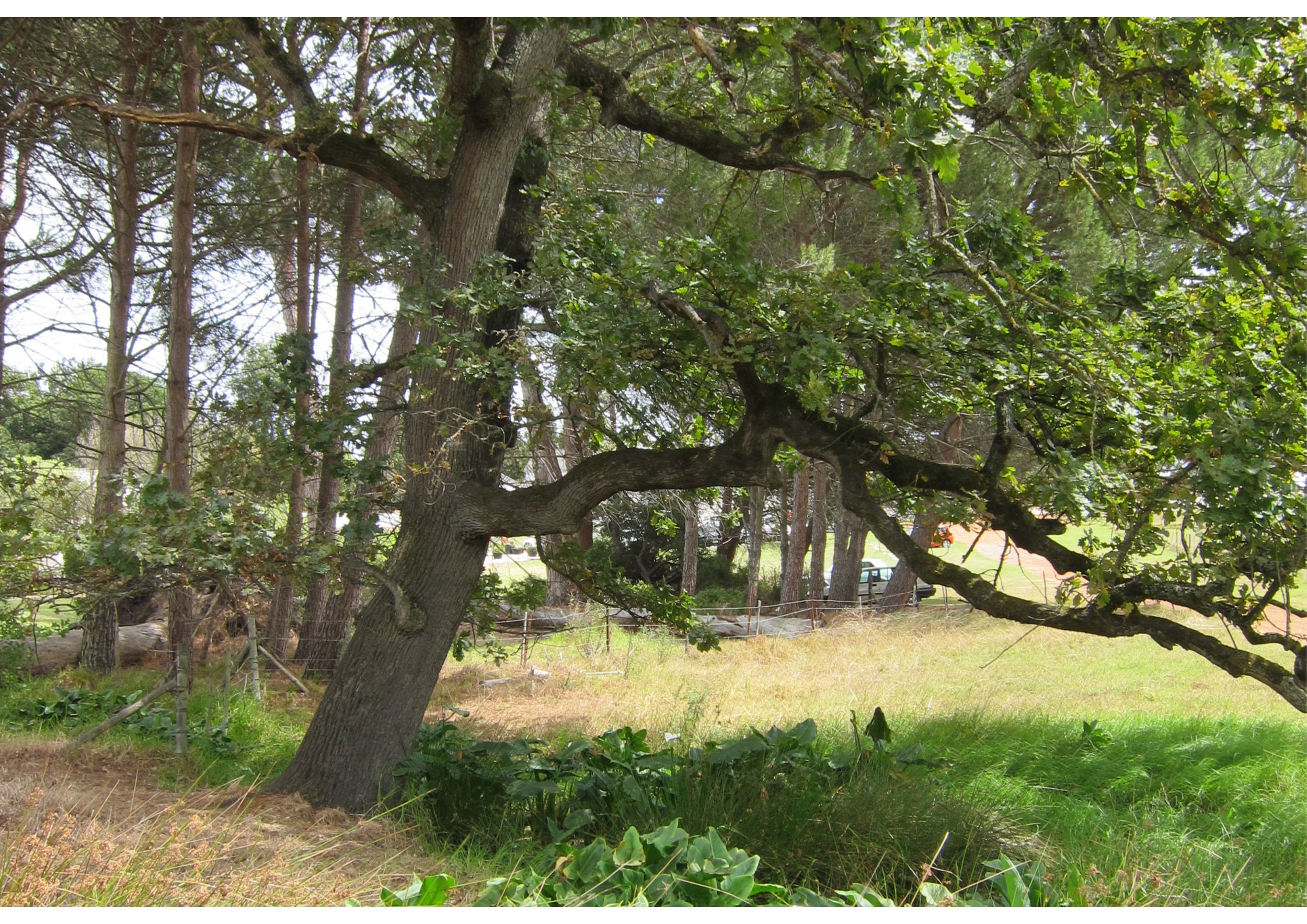
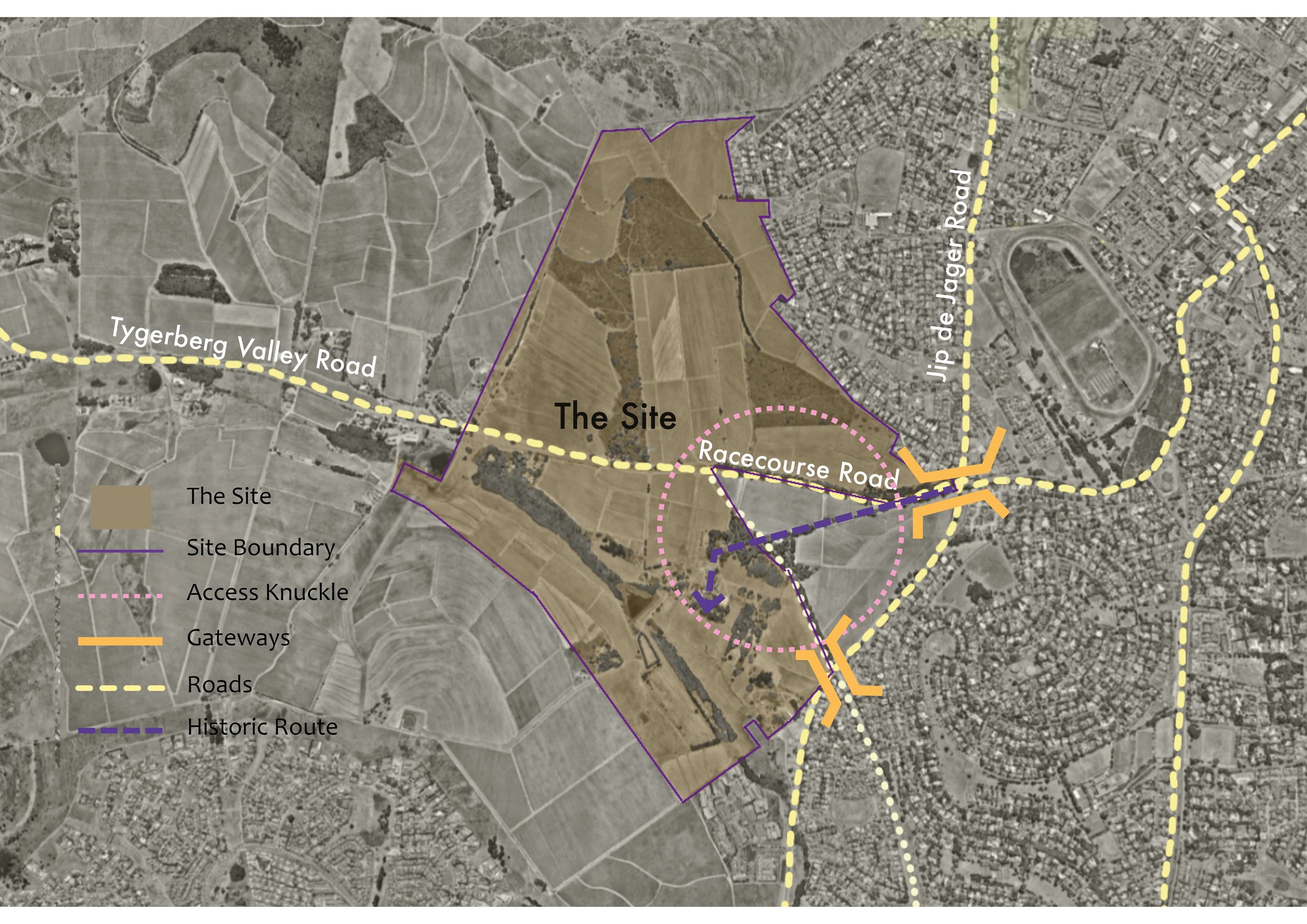
In local context we studied access to the site which was discovered is via two main roads: Jip de Jager connects to the N1, while Tygerberg Valley Road links to the N7. Historical routes, visible in existing tree avenues, have been modified over time. Figure 1.21 shows the site's strategic position as a gateway to both rural and suburban areas.

The diagram below combines the various site analysis layers which make up the cultural landscape in its local context. This summary map clearly illustrates the complexity of the site context and the interdependency of the various layers and elements. It is evident that minor changes to this landscape and structures may have significant implications and should be considered with care and caution.
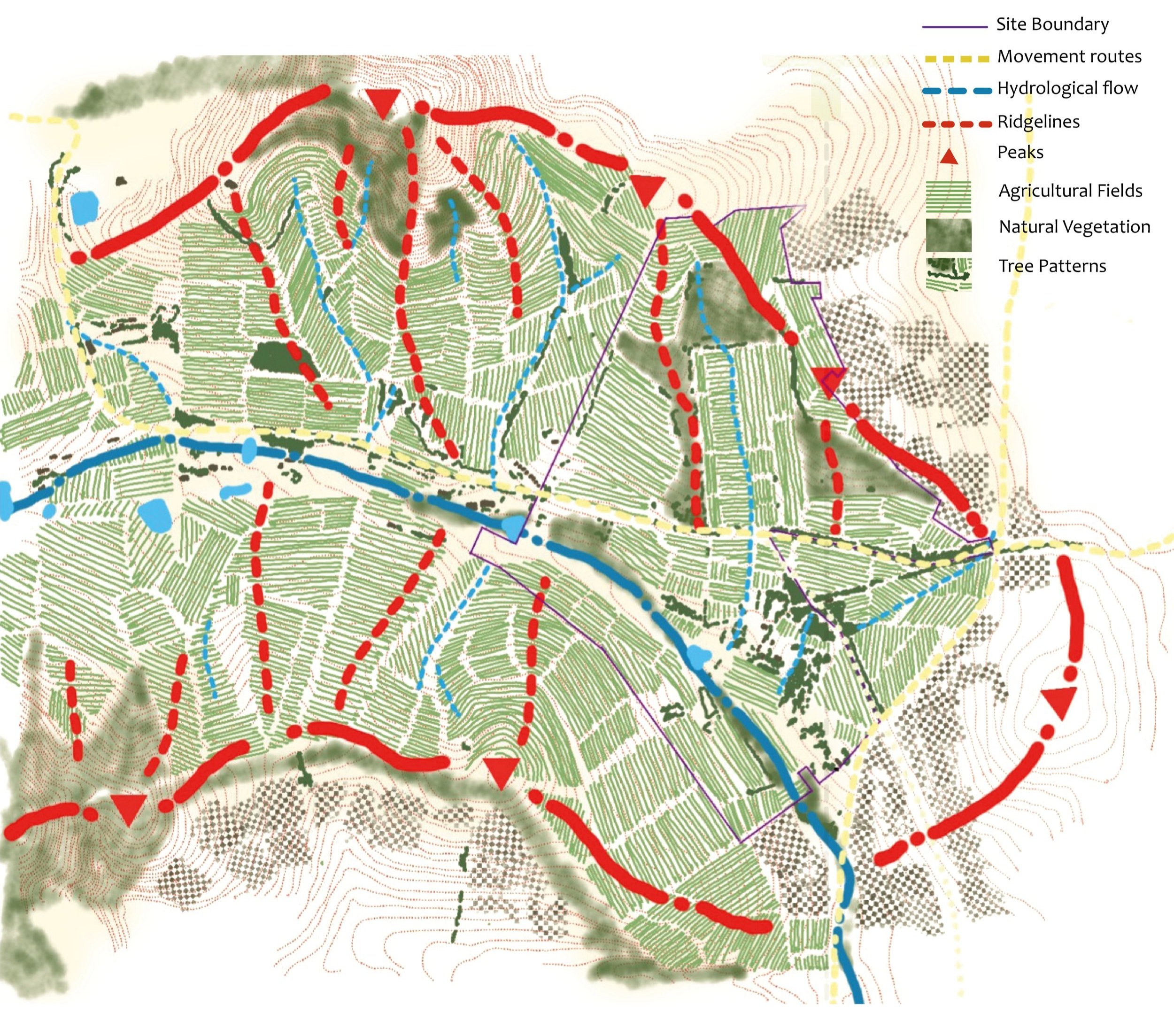
The identity and sense of place of the site and the context is highly nuanced and subtle. Intervention in such a fine balance of elements must apply the same level of subtlety and discretion.
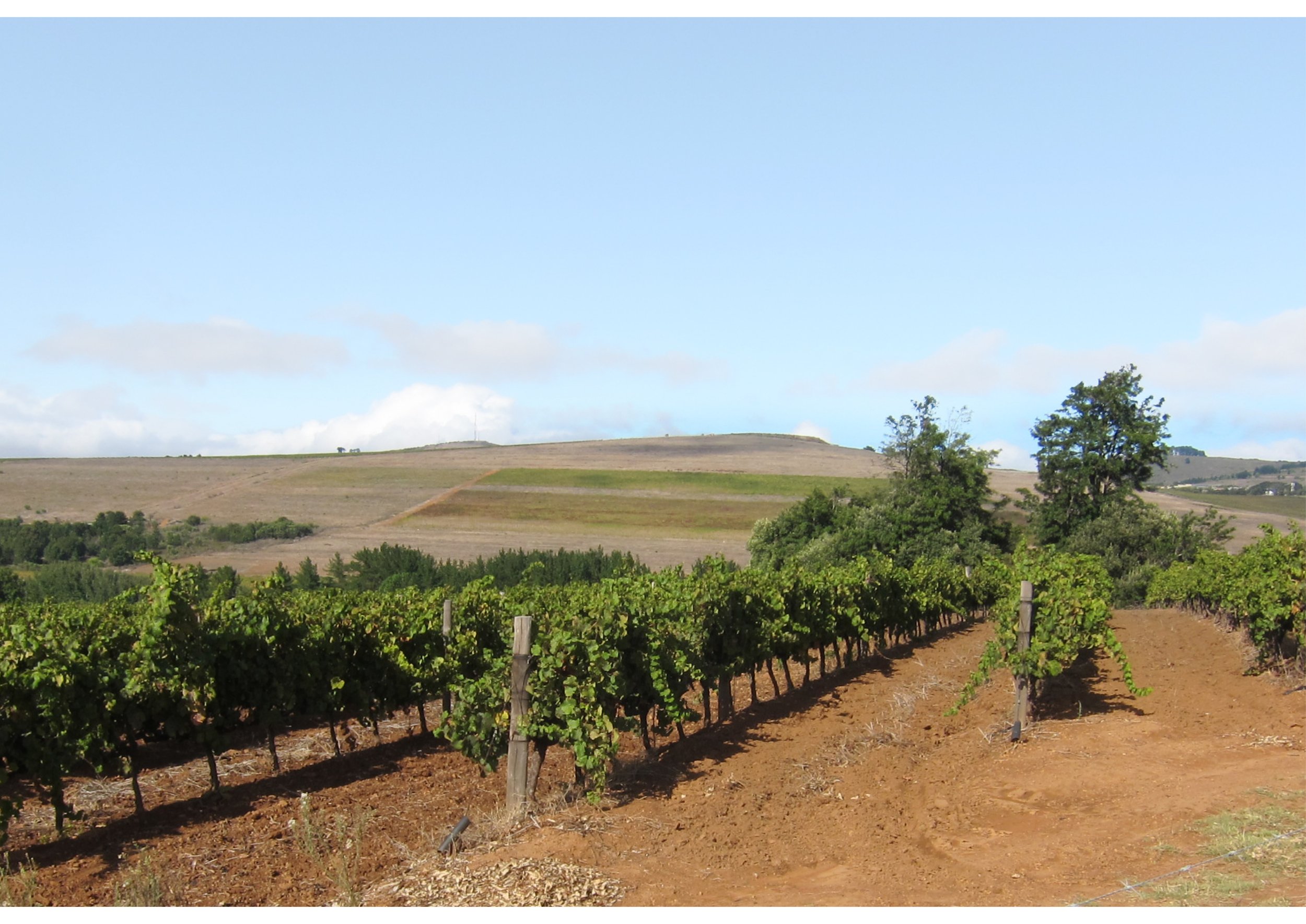
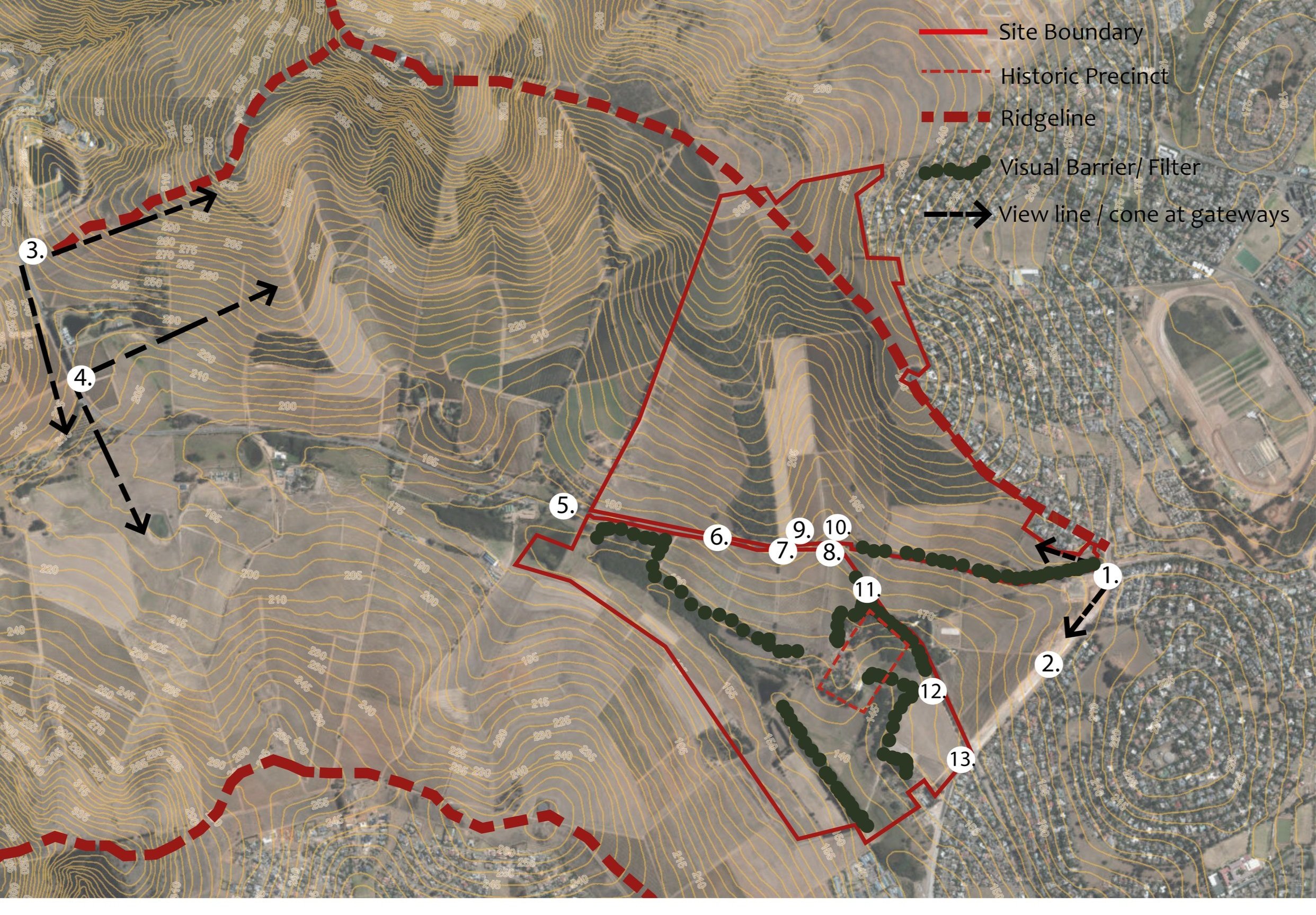
Key viewpoints have been identified within the context of the site. These are experienced by the general public from outside and alongside the site.
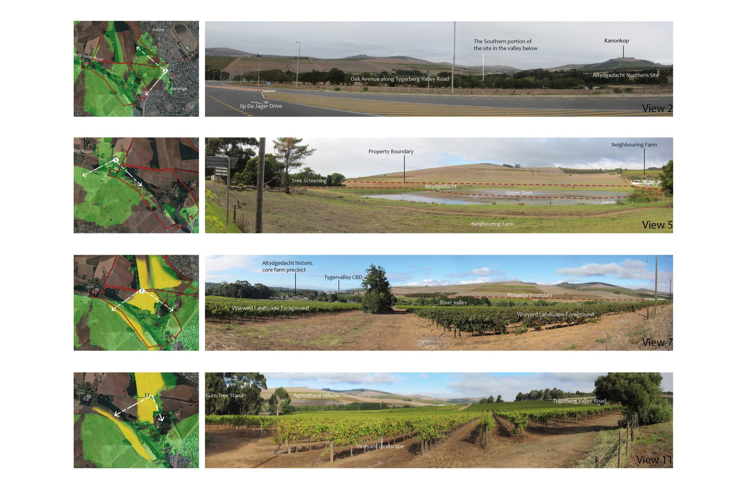
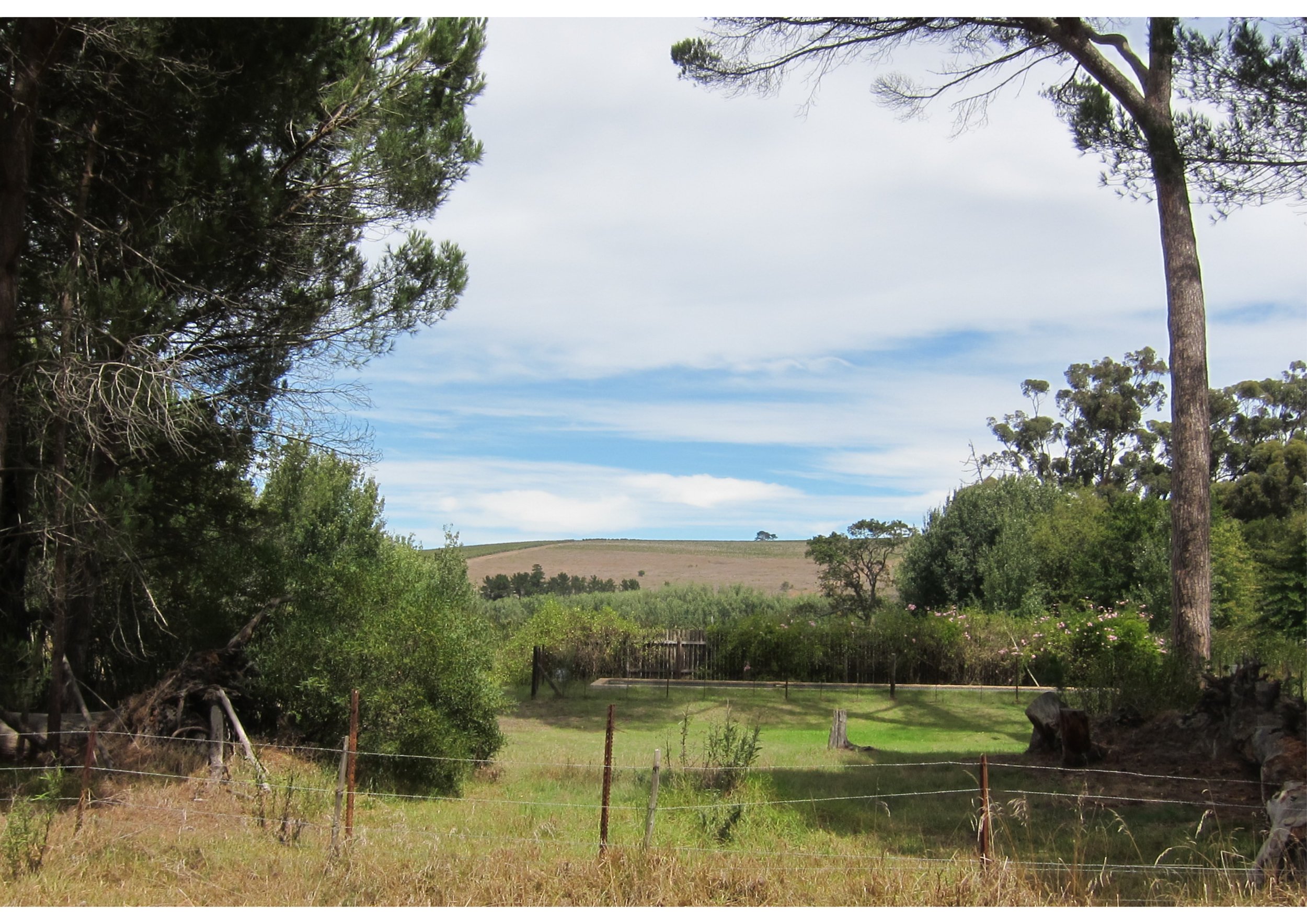
At the site scale, our analysis focused on identifying key viewpoints to assess the site's visibility from specific perspectives. Additionally, we conducted studies on movement routes, the heritage core, hydrology, green elements such as agriculture, the tree framework, and natural green areas.
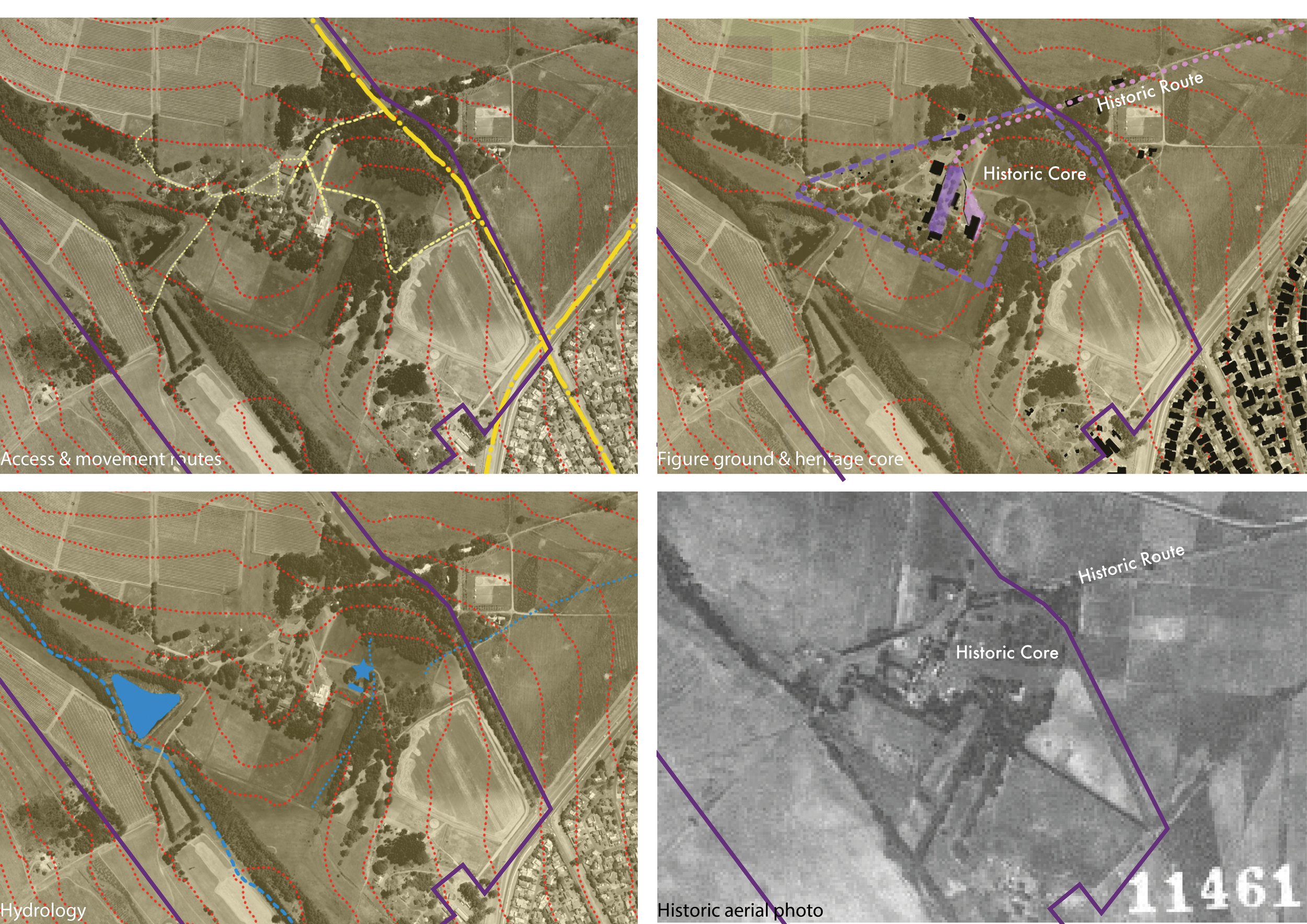
1. Landscape settlement patterns of farmstead was ‘haphazard’ and not a typical ‘werf’ layout.
2. Access to the site in unconventional
3. There are a number of drainage lines and a river integral to the site and site development
4. Historic routes were ‘lost’ due to the change in ownership over time.
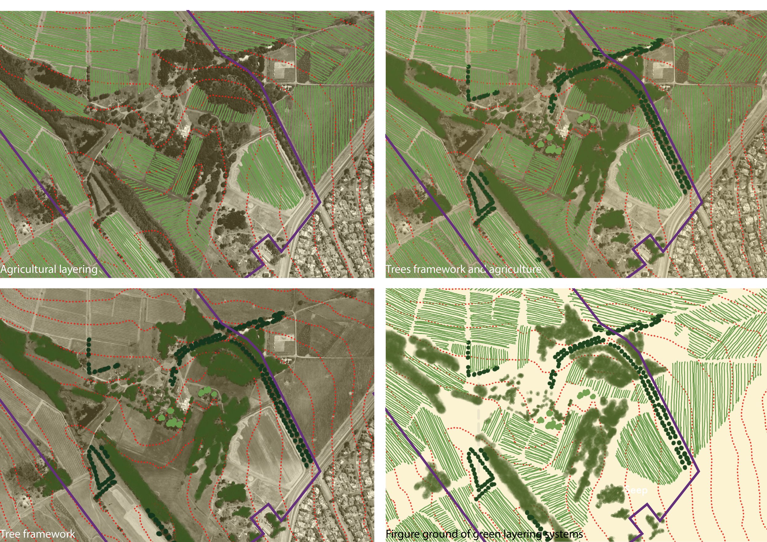
1. Agricultural patterns were a strong ordering system in the landscape and part of the identity
2. Tree planting clearly denotes space
3. A combination of feature trees and avenues trees. Tree planting creates a screen between homestead and surrounding urban development.
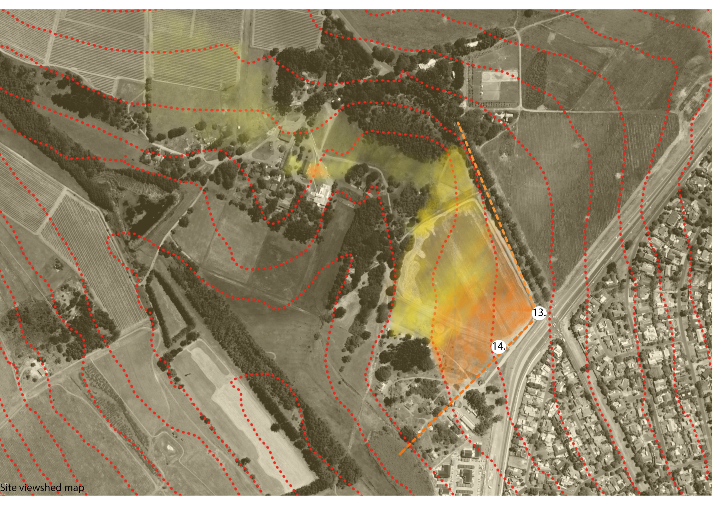
Key viewpoints at site scale identified prominent elements on site, and enabled us to study the landscape in terms of if foreground, mid ground, and background.
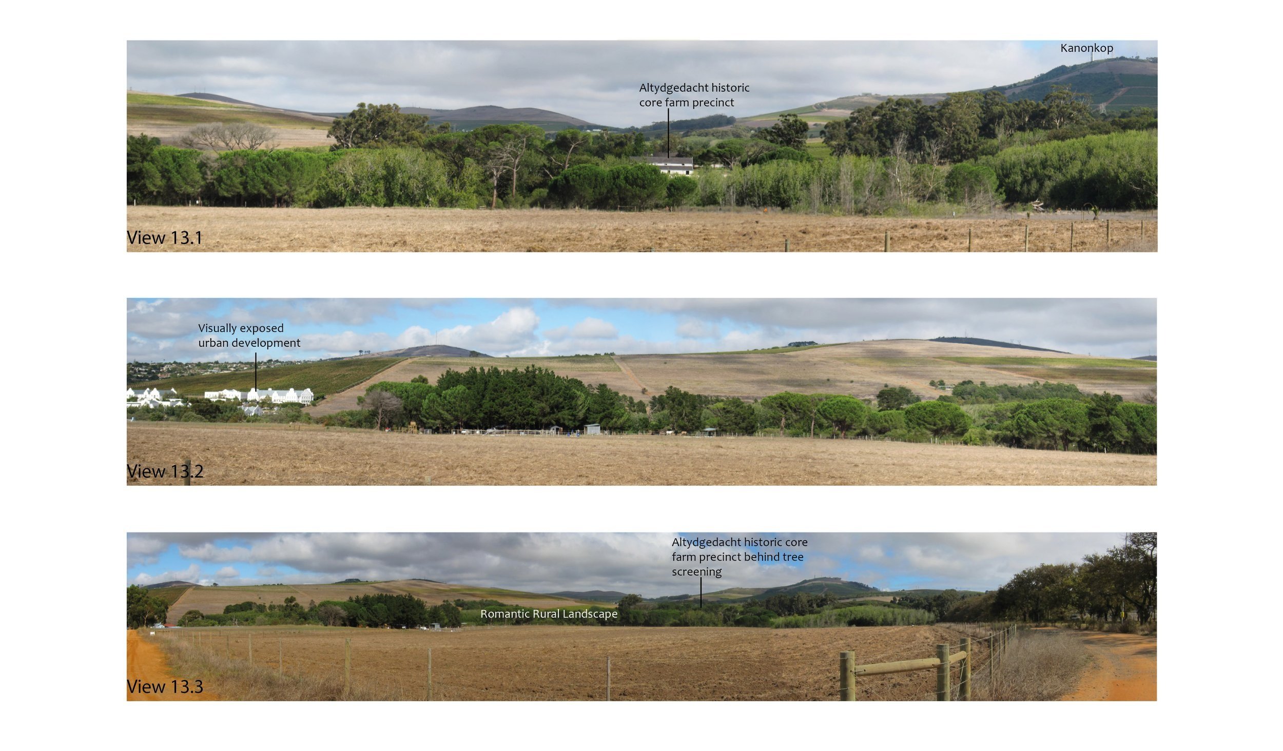
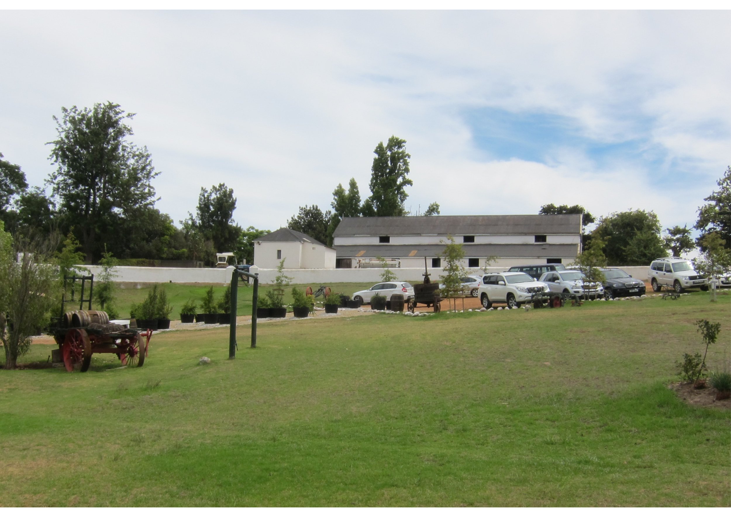
This report served as a baseline study in order to collate all the visual and landscape indicators from outside and within the site. These informants will serve to guide recommendations for opportunities and constraints for the next phase of the project.
Have a look at the Altydgedacht Framework Plan